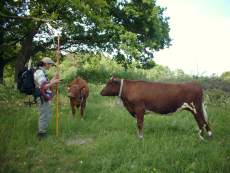
Field inventory
Last changed: 13 January 2023
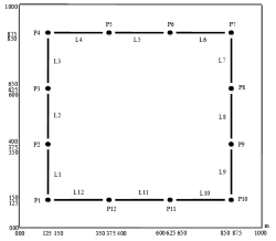
Field inventory takes place in fixed sample plots and lines within every NILS kilometer square (1x1 km). Each NILS square is inventoried every fifth year.
Aerial photo interpretation and field inventory are closely related since the sample plots are inventoried in the field and the locations of point and line objects are decided in relation to the aerial photo interpreted areas and objects. The sample plots' sizes correspond in large part to the smallest map unit in the aerial photo interpretation.
The field inventory uses, as often as possible, the same variables and definitions that are used in the aerial photo interpretation. In the field, however, a large number of variables that can not be detected in aerial photos are also registered.
The field inventory information is collected in a fixed grid pattern of permanent sample plots and in line objects encountered during line inventory.
The sample plots form a basis for estimating quantity, condition and change of types of landscape covering the area. From these a representative random sampling of the entire land area of Sweden is received.
More information about the field inventory in NILS can be found in the 2007 Field instruction.
Links