Contact
Department of Aquatic Sciences and Assessment, Division of Geochemistry and Hydrology

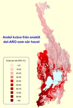
FyrisNP calculates riverine transport, retention and source apportionment of nitrogen and phosphorus in river basins. The model has been applied since the mid-1990s in several small and large water systems in Sweden with Göta River basin (50 000 square kilometers) as the largest.
The model is an excellent assessment tool for the EU Water Framework Directive and the impact analysis that should be done. By simulating the effects of different measures to reduce emissions of nutrients FyrisNP also provides a basis for design of program of measures.
The close link to ongoing research at SLU enshure that the model is continuously developed and tested. Below are links to download the latest version of the manual and technical description. Water authorities, county administrations, water conservation societies, municipalities and universities can contact SLU water HUB if you want to use the FyrisNP model.
We recomend a one day tailor made education on input data and handling of the model before starting to use FyrisNP.
Download FyrisNP manual. The user's manual have also been translated into Russian.