County of Gävleborg, Ljusdal (61° N, 16° E)
Last changed: 02 June 2021
In winter 2020, a new project started where 26 adult moose (19 cows, 7 bulls) were tagged in the municipality of Ljusdal in areas where the three major forest fires (Ängra, Nötberget and Vitmyran) changed the landscape dramatically in summer 2018. In total, the forest fires affected an area of 9,500 hectares that fundamentally changed the living conditions for wildlife. Moose benefit from increased access to new vegetation as young forest. Like following the large storms in the county of Kronoberg that transformed large parts of the older forest landscape into young forest, forest fires increase access to young forest habitats. The project will run for 3 years to improve our understanding how the moose population in the area is affected by these changes, how they use the landscape and utilize the habitats in relation to the fire fields, and to study their reproduction (number of calves and survival) during the coming years. The project is funded by Sveaskog.
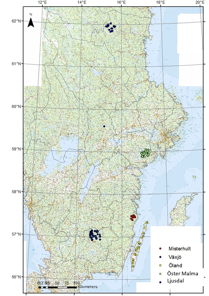
Map showing first tagging position.
Please use the link below to see the movement patterns of the GPS-marked moose in Gävleborg.
http://webmap.slu.se/website/moosetrack_BD/ (opens in a new window)
Abbreviations: HK-Haparanda-Kalix, HA-Harads, LJ-Ljusdal, NM-Nordmaling, F or M-Nikkaluokta.
If the map does not appear, your browser window may need to be reduced in size and/or popup blockers must be disabled.
Contact
Wiebke Neumann Sivertsson, Researcher
Department of Wildlife, Fish and Environmental Studies
Department of Wildlife, Fish and Environmental Studies
wiebke.neumann@slu.se, +46907868117, +46706349051
Back