Long-term records from 2010 to 2023 are available for runoff and water chemistry in 10 regularly monitored sub-catchments. The dataset includes measurements of runoff and the following water chemistry parameters:
-
Data Access & Metadata:
-
Retrieved from SITES data portal https://data.fieldsites.se
-
A link to the full metadata landing page is available in the downloaded ZIP file.
-
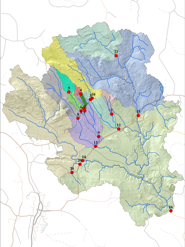
Here you can download GIS data available at Krycklan
This geospatial dataset provides a high-resolution foundation for environmental and hydrological research in Krycklan. It includes high-resolution insights into terrain, hydrology, land use, and soil characteristics.
- Digital Elevation model 0.5 m DEM
- Stream network during average flow
- Krycklan catchment polygon
- Regular Catchments polygon
- Survey catchments polygon'
- Krycklan Orthophoto 17cm
Other Data can be accessed from
- geodata service
- SLU's download service GET.
- The Forestry Agency's ftp.
Climate data from the Svartberget catchment is available for the period 1991–2023, and includes the following key parameters:
- Precipitation
- Air temperature
- Vapour pressure
- Global radiation
- Wind speed
Daily values are calculated based on a 5-second scan interval across the 00–24 HR period
- Data can be accessed at the SITES data portal : https://data.fieldsites.se
- Other data can be access through Svartberget reference data
Data Policy:
This dataset is licensed under a Creative Commons Attribution 4.0 International License.