
She’s fighting fire with data
What increases or limits wildfire likelihood and its severity? That’s what PhD student Sara Jones is trying to find out. She hopes that a better understanding of wildfires can help us manage forest in ways that that reduce risk.
Sara has been interested in wildfire for a long time, as she grew up in a region where wildfire was common. Later while studying Geographic Information Systems, she discovered how powerful map data can be for understanding landscapes. When the opportunity came to study wildfires in Sweden with supervisor Igor Drobyshev, she did not hesitate.
From data to models to maps
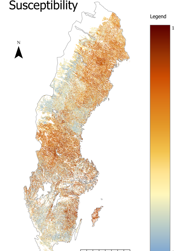
Using satellite images and map data Sara trains computer models that show how different forest factors – such as tree species or volume – affect the likelihood of fire. This can be used to understand how different forest management practices influence the risk of fire.
‒ The models are then used to create maps that illustrate where forests may be more or less susceptible to burning. Maps are an extremely effective way to communicate these risks and opportunities for management, says Sara, and continues:
‒ This can help forest owners and the forestry industry compare the costs and benefits of different strategies and choose the right level of risk reduction.
Key findings and looking ahead
One of her findings shows that forests with a high standing volume of Scots pine are more likely to burn, while forests with high volume of broadleaves are less fire-prone. However, there are many other factors that influence fire risk, and more research is still needed.
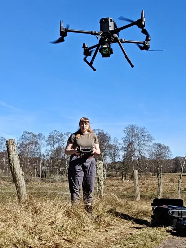
In collaboration with her colleagues, Sara also comparing fire-mapping methods and collecting drone-based data of prescribed burns. The goal is to better understand fire behaviour in Sweden, reduce risks, and perhaps even explore its role of fire as a conservation tool.
Here you find an published open source map of large fires in Sweden, which is free to download and use: https://doi.org/10.5281/zenodo.14677631
If you want to read more about the project you can find the first paper here: https://doi.org/10.1016/j.ecolmodel.2024.110942
Contact
-
Person
-
PersonTheres Svensson, communikation officer for The Forest Damage CentreFaculty of Forest Sciences