
New hyperspectral drone pushes forest stress monitoring to a new frontier
SLU Forest Damage Centre has expanded its capabilities with Sweden’s first co-aligned VNIR–SWIR–LiDAR hyperspectral drone system for advanced forest stress detection.
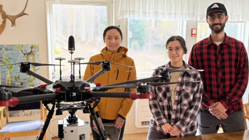
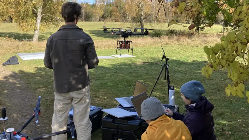
Researchers at the SLU Forest Damage Center has acquired a state-of-the-art hyperspectral drone system that captures forest health signals in unprecedented detail. The system simultaneously records data in different light ranges*, as well as 3D information about the forest, all using a sensor rig mounted in a heavy lifting drone. This allows researchers to monitor stress in trees earlier and more reliably than ever before.
Traditional optical cameras struggle to detect fine physiological changes before trees show visible symptoms. The new system, which measures light across the 400–2500 nm range and include 3D information about forest structure, can detect early biochemical and water-related stress signals while correcting for structural variations in the canopy—a major challenge in forest remote sensing.
‒ With this system, we can see forest stress before it becomes visible to the human eye—sometimes weeks to months earlier. This opens a completely new window for damage mitigation, especially for drought and bark beetle outbreaks, says Dr. Langning Huo, Associate Professor at SLU and principal investigator of the initiative.
A unique system for Nordic forests
This is the first drone system in Sweden that combines hyperspectral VNIR, SWIR and LiDAR in a perfect aligned setup - and the first of its kind in Europe specifically deployed for forest stress monitoring. Its design enables:
Real-time synchronized spectral, water-content, and structural measurements
Earlier detection of drought, insect attack, and disease
Improved upscaling from drone to airborne and satellite monitoring
Reduced uncertainty from changing sunlight or sensor alignment issues
Previous work led by Dr. Huo demonstrated that hyperspectral drones could detect tree stress with up to 80% accuracy at the early stage [TS5] [LH6] of bark beetle infestation — nearly doubling the performance of multispectral sensors. Thanks to the new SWIR and LiDAR capabilities, it is now possible to quantify water status and separate actual physiological stress from structural effects such as tree size, shape, and shading. By combining this system with SLU’s existing high-performance hyperspectral drone, a unique dual-drone remote sensing platform has been created, designed to improve early detection of forest stress throughout Sweden’s boreal and temperate forests.
From physiology to operational forest protection
This dual-drone approach helps SLU progress from experimental measurements to a operational early-warning system. By linking spectral data with tree physiological measurements—such as pigment composition, sap flow, and hydraulic stress—researchers aim to detect drought, insect attack, and disease before visual damage appears.
‒ This is critical for time-sensitive disturbances such as spruce bark beetle outbreaks, where management decisions must be made weeks before trees discolor, says Langning.
Supporting national research collaborations
Both hyperspectral drone systems are being used in collaborative projects involving ecology, entomology, pathology, hydrology, and forest management. The sites include climate-stress experiments in Krycklan (northern Sweden) and Tönnersjöheden (southern Sweden), positioning SLU at the forefront of integrated forest stress research.
Co-funded for national benefit
The new system is co-funded by Kempe Foundations, Formas, Carl Tryggers Foundation, and a monitoring project is funded by the SLU Forest Damage Center, reflecting the growing national demand for cutting-edge methods to protect forest resilience and productivity.
* The different light ranges:
VNIR: visible to near infrared spectrum with wavelength between 400 nm to 1 000 nm
SWIR: short-wave infrared spectrum with wavelength between 1 000 nm to 2 500 nm
LiDAR: Light Detection and Ranging, a technology that uses laser light to create extremely detailed 3D maps of the world
Contact
-
PersonLangning Huo, ResearcherDivision of Forest Remote Sensing
-
PersonTheres Svensson, communikation officer for The Forest Damage CentreFaculty of Forest Sciences