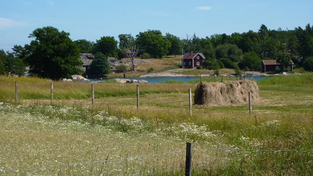
Regional monitoring in landscape squares (Remiil) – farmland biotopes, grasslands and wetlands
SLU monitors farmland biotopes, grasslands and wetlands in collaboration with the county administrative boards. We monitor habitats that are important for wild plants and animals and how they develop over time.
To collect data, we inventory the landscape using aerial photographs and field visits. In the field, we also register plant species.
Regional monitoring in landscape squares (Remiil) started in 2009. The results from the monitoring can contribute to following up on the regional environmental objectives A varied agricultural landscape and A rich diversity of plant and animal life. A large number of county administrative boards participate in the monitoring programme, and the assignment to SLU is coordinated by the county administrative board in Örebro. SLU carries out the monitoring, manages the data and analyse the results.
Farmland biotopes
Farmland biotopes are important habitats and dispersal corridors for many species. We monitor the number, quality and diversity of such biotopes and where in the landscape they are located.
First, the arable land is delimited in the landscape squares through aerial photo interpretation and then we make a complete mapping of the biotopes along the field edges and in arable land. For each type of biotope, the field workers note the location, sun exposure, overgrowth, tree species, etc.
During the years 2009-2020, the following farmland biotopes were included:
- Field islets, ponds and small wetlands
- Ditches, vegetation strips and farm roads
- Flowering trees and shrubs
- Stone walls and other stone substrates
- Species-rich meadow fragments
- Alleys and other valuable trees
For the period 2021-2026, a revision of the content has been made, in collaboration between SLU and participating county administrative boards. The focus is on more accurately describing the occurrence and changes of structures such as field edges and field islets in aerial photos, while the field inventory focuses on flowering trees and shrubs in field edges. The new selection has been made so that the regional small biotope inventory will be as good a complement as possible to Remiil's mapping of grassland green infrastructure and to the new national monitoring of farmland biotopes.
Grasslands
To know whether we are achieving the environmental objectives for biodiversity in and outside the agricultural landscape, we need to find out how the areas and qualities of grasslands are developing over time. We also want to know how the grasslands are located in the landscape and whether there are opportunities for plant and animal species to spread.
Right from the start in 2009, we chose to include other grasslands in the agricultural landscape in addition to the most valuable meadows and pastures. Since 2011, we have been working on developing alternatives for how to expand monitoring to include even more grassland types. These lands can be important as habitats for many species and for connecting the landscape's core habitats.
From 2015, the following grassland types are included
- Cultivated arable land (control plots only)
- Arable land and former arable land that is unused or has permanent grazing/mowing
- Pastures and meadows
- Sea shore meadows and other wet grasslands
- Field edges
- Lawns and other constructed grasslands around farms (not visited in the field)
- Extensively managed grass-covered land (e.g. large field islets)
Wetlands
To be able to see whether we are achieving the environmental objectives set for wetlands, we need to know how areas of different wetland types and qualities for biodiversity develop over time. We also want to know to what extent the wetlands are exposed to and affected by different types of interventions, such as ditches or vehicle tracks.
During the previous programme period 2009-2014, only wetlands with peat-forming vegetation and/or other peatland with more than 30 cm of peat depth were included. From 2015, other non-peat-forming wetlands are also included – not least to capture the more or less humid-wet grassland environments that exist in the landscape, mainly around sea shores.
Aerial photo interpretation provides information about the distribution of wetland types, tree and shrub cover and different types of interventions in the wetlands. By also interpreting older aerial photos, we will be able to show the development from the 1980s to the present day.
Data
For farmland biotopes, there is are estimates of areas and densities and a number of assessment variables for each biotope type, based on a full-cover mapping along field edges in landscape squares.
For grasslands and wetlands, a comprehensive mapping of different grassland and wetland types is done with aerial photo interpretation, and in the wetlands, linear interventions such as ditches are mapped. In addition, a field inventory of permanent plots is done in grasslands and wetlands.
Contact
-
PersonAnders Glimskär, Researcher