
Drones have potential for moose surveys – but weather can be a limiting factor
Drones are a highly effective tool for counting moose, weather permitting. This is one of the conclusions of a report by researchers at SLU on behalf of the Swedish Environmental Protection Agency. The limitations of the method must be addressed before it can be fully utilised in management.
– This is the first evaluation of the method in Sweden, and we can see that drones, when used correctly and under the right conditions, can be very effective as a tool for moose surveys, says Tim Hofmeester, a researcher at the Swedish University of Agricultural Sciences (SLU) and one of the report’s authors.
Determining the age, sex and number of animals in an area provides important data for wildlife management. Today, there are well-developed systems for monitoring the development of the moose population through pellet count surveys and moose observations (älgobs). At the same time, technological developments have progressed rapidly, and new methods can complement the existing ones. Companies are already offering surveys using drones and thermal cameras that detect the animals from the air. However, there is no common standard for drones, and therefore the method does not yet have the same status as the quality-assured methods used in wildlife management. On behalf of the Swedish Environmental Protection Agency, researchers have tested and analysed the method to determine whether drones can provide sufficiently reliable data for wildlife management.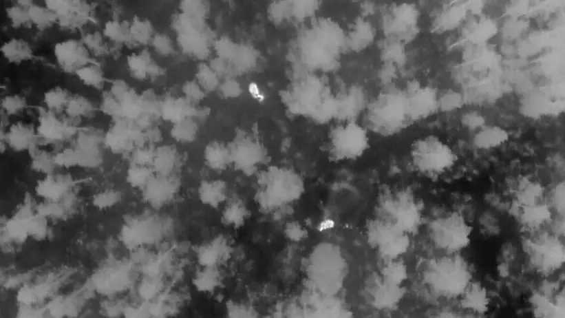
Best in perfect weather conditions
The results show that the method is virtually 100 percent effective at locating moose. At least when it is cloudy, cold and windless in relatively open woodland.
– In perfect weather conditions, we found virtually all the moose in the area. The method was very effective then. But if the sun comes out, uncertainties arise. It is difficult for the pilot to distinguish warm rocks from animal bodies as they look the same on the thermal image; at the same time, warm treetops can also hide moose, says Tim Hofmeester.
According to the report, drones can be used to survey sex distribution and the number of calves per cow, but it can be difficult to distinguish between sex and age. Here too, the weather needs to be good, and it requires both an experienced drone pilot and the ability to take clear images. Furthermore, a greater amount of work is needed to achieve a sufficient number of observations for a reliable result.
– The fact that the method works best under perfect conditions limits its use. Our conclusion is that certain sample areas must be surveyed several times to gauge how likely it is to actually find the moose that are present if weather conditions are not perfect, says Tim Hofmeester.
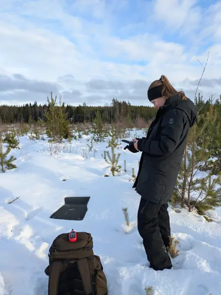
The report provides recommendations on camera types and flight altitude. The researchers note that many drone companies are aware of the challenges and that only minor changes to their procedures are required, based on the researchers’ recommendations. However, a specific certification for drone pilots is needed to ensure further quality assurance before the method can be used in as a basis for management decisions. Furthermore, important work remains to be done to compare the results and uncertainties with existing methods before it can be considered quality-assured.
– Drones do not replace existing survey methods, but the report is an important step in the development of future methods. The report provides us with a better basis for our ongoing work on guidelines and quality assurance. At the same time, it highlights areas where more knowledge is needed, for example regarding how weather, season and different types of forest affect the results, says Anders Broby, wildlife management officer at the Swedish Environmental Protection Agency.
Moose population surveys
Knowledge about the size and development of the moose population forms the foundation of moose management in Sweden. Wildlife managers currently rely on four quality-assured core methods to estimate population size and composition. Each method has its strengths and limitations, and they are used in combination to provide the most reliable results.
The core methods are:
- Moose observations (Älgobs), recorded by hunters during a specified period in connection with the hunting season.
- Pellet count surveys, where the number of moose droppings is used as an index of population size.
- Harvest statistics, based on the number of moose harvested during the hunting season.
- Carcass weights of moose calves, which reflect forage availability and the overall condition of the population.
There are also additional approved survey methods, although these are generally less cost-effective. Examples include surveys conducted using helicopters or fixed-wing aircraft.
The report on drone-based moose surveys represents a first step towards the future use of this method in wildlife management.
Contact
Tim Hofmeester, researcher at the Department of Wildlife, Fish and Environment, SLU in Umeå. 076 144 8757, tim.hofmeester@slu.se
Anders Broby, wildlife officer, Wildlife Analysis Unit, Swedish Environmental Protection Agency. 010-698 17 57, anders.broby@naturvardsverket.se