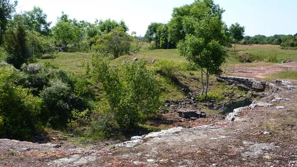
Monitoring of grassland and rock habitats
Some habitat types occur in mosaics with other habitat types or are concentrated in parts of Sweden. In order to get a useful sample of them, a more targeted methodology is required.
From 2015, SLU has used new methodology to monitor several habitat types that belong to this category, for example different types of hay meadows. Some of these habitat types are well known from other surveys, such as alvar on Öland and Gotland. The monitoring is important for Sweden's reporting of habitat types to EU Species and Habitats Directive.
The following habitats are currently being monitored (with the EU code for each habitat).
- Siliceous rock with pioneer vegetation (8230) and Rupiculous calcareous grasslands (6110) on the mainland
- Calcareous rocky habitats on Öland and Gotland: Nordic alvar (6280), Rupiculous calcareous grasslands (6110), Limestone pavements (8240)
- Alluvial wet meadows (6450) by large watercourses
- Lowland hay meadows (6510), Mountain hay meadows (6520) and Wooded meadows (6530)
- Inland sandy grasslands: Inland dune grasslands (2320), Dry sand heaths (2330) and Xeric sand calcareous grasslands (6120)
How the monitoring is done
Infrared colour aerial photographs are used to locate sites to be inventoried. Then, a field visit provides more information about species and conservation status.
Siliceous rock with pioneer vegetation
The rocky habitats are characterized by mosses, lichens, succulents and annuals on thin, dry ground with sparse and thin soil at rock outcrops. It is often difficult to determine from aerial photographs which rock outcrops have this type of ground cover and species. Often we have to determine the habitat in the field. Rock outcrops that do not meet the requirements can be either completely bare rock outcrops, rock outcrops in the forest landscape or those that have a dense and thick cover of reindeer lichens or mat-forming forest mosses.
Alluvial meadows
The alluvial grassland habitat is found mainly along larger, unregulated watercourses in northern Sweden (from the Dalälven River and north) with natural water regime and annual flooding. Some are still maintained by grazing or mowing. Those that are unmanaged have often been used for wetland mowing in the past. Alluvial meadows are characterized by tall sedge vegetation with e.g. Carex acuta, Carex aquatilis, Calamagrostis purpurea, Equisetum fluviatile and Comarum palustre. The goal is to map all alluvial meatows along the larger northern watercourses.
Nordic alvar, Rupiculous calcareous grasslands and Limestone pavements
Alvar, basic rock outcrops and karst outcrops are mainly found on Öland and Gotland, with only minor occurrences on the mainland. Since these are areas with unique habitat types and high natural values, dense sampling is justified. Therefore, 1 x 1 km is used as the square size, which reduces the time required per square and therefore enables a significant increase in the density of the sample compared to other grassland monitoring. The total sample consists of a total of approximately 300 squares per year (1800 over a six-year period) distributed throughout Öland and Gotland. Of these, we expect that approximately half contain one or more of the three included limestone habitat types.
Hay meadows
Hay meadows are sparse and can vary greatly between different regions and landscape types. The purpose of the monitoring is, among other things, to investigate how the vegetation in hay meadows differs from pastures and how the character of hay meadows differs between different parts of Sweden. Mountain hay meadows differ from lowland hay meadows in that they are located closer to the mountains, e.g. in mountain dairy farms and summer pastures (fäbodar). The wooded meadows habitat often has elements of pollarded trees and other valuable deciduous trees, and they are particularly common on Gotland.
Data
Data are available for all of the above habitat types, but with different starting years. For Siliceous rocks, monitoring began in 2015, for alvar and alluvial meadows in 2017, and for hay meadows in 2020. Within the mapped areas, we place sample plots of the same type and with the same variables as within Remiil and environmental monitoring in powerline corridors. In alvar and limestone pavements, there are additional variables for karst cracks. For siliceous and calcareous rocks on the mainland, data are normally summed per mapped polygon.
Contact
-
PersonAnders Glimskär, Researcher