Ground-penetrating radar systems: making qualitative forest soil data quantitative
Project overview
More related research
Short summary
Analysis of soil structure in forest environments often relies on time-consuming and sometimes destructive sampling. This project develops innovative radar systems for non-invasive measurements of soil properties, enabling improved decision-making in forestry and environmental management.
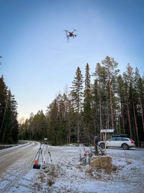
Drone-borne radar is a rapidly emerging and powerful method for investigating soil properties, particularly when integrated with qualitative topographic data and other complementary geospatial information. By combining high-resolution airborne measurements with advanced signal processing, entirely new opportunities are created to analyse soil structure, composition, and variability across both small and large areas.
The project makes use of ground-penetrating radar systems, synthetic aperture radar (SAR), a radar technique capable of producing detailed images of the ground even through vegetation and clouds, and laser-scanned terrain models to obtain both an overview and a detailed representation of soil structure. By combining information from multiple data sources, the research links what is visible above ground with structures below the surface, enabling a more comprehensive understanding of forest landscapes.
The research aims to develop methods for accurately mapping soil moisture, soil depth, stratification and other geophysical properties, such as stoniness and the distribution of biomass. These are important for environmental research, land-use planning and agriculture. A key advantage of the methods is that they are non-invasive, meaning that data can be collected without disturbing the soil through digging or sampling.
The work focuses primarily on radar in the P-band and L-band frequency ranges, which have strong penetration capabilities and can detect structures beneath the surface. The methods also have the potential to be scaled up and applied across larger geographical areas, for example in regional monitoring of soil conditions or as part of broader remote sensing systems.
Research team
PhD student: Noak Wallgren
Main supervisor: Henrik Persson
Assistant supervisors:
Jonatan Klaminder
Johannes Larsson
Anneli Ågren
Collaborator: Guideline Geo
Project period: September 2025 – September 2030
This project is part of WIFORCE – the Wallenberg Initiative in Forest Research, funded by the Knut and Alice Wallenberg Foundation.