From idea to final-year project
Curious about what it’s like to write a degree project at SLU? Follow Klara, a student at SLU, and join her journey through the thesis process – from the initial idea to the completed project.
24 March 2026: Fieldwork continues
We were incredibly lucky with the weather throughout the entire trip. There was only one night of strong winds, which could be heard sweeping through the valley and surging across the water before crashing into our camp. It was a bit exciting, but everything held up - apart from one tarp, which now needs repairing before the next adventure. Otherwise, we experienced short bursts of rain, but it was always wet in the forest, so the best way to stay dry was to wear waterproof gear. This was perhaps a little less successful on days when it felt like proper summer, but that was quickly remedied with a swim in the Pacific Ocean.
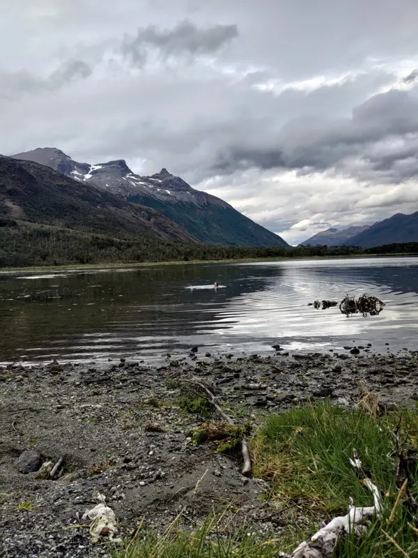
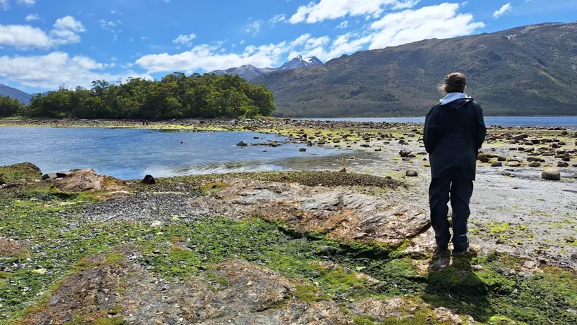
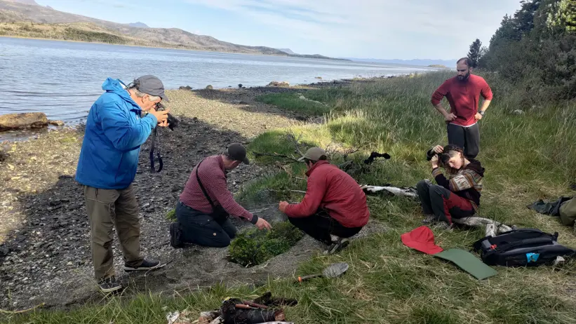
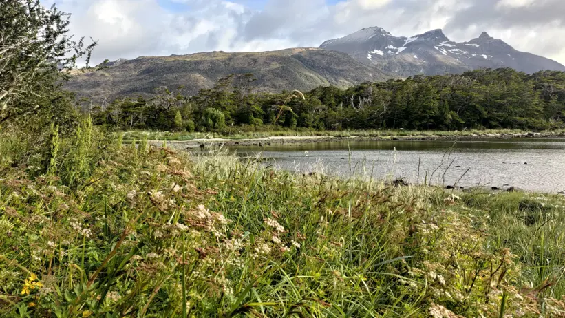
This study is interdisciplinary and combines several different research fields in order to best describe why and how people lived here. One component is archaeology, where we carried out a full survey of the entire shoreline and the surrounding forest. What is particularly striking here is the abundance of stone formations, ranging from fish traps and storage areas to the mussels that were collected. There are also canoe runs and boat channels that have been cleared of stones to make it easier to pull canoes ashore without damaging them. At the edge of the forest, there were conchales - piles of shells and bones, something like a compost heap. They were difficult to detect as they were covered by vegetation, but they reveal that people once lived here.
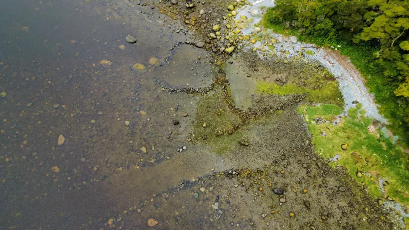
The final discipline I focused on was marine resources. In order to live in a place, food is essential, and here shellfish have been an important part of the diet. By examining how much shellfish there is and where it is found, this can provide an explanatory factor for the other results. The survey was carried out using transects, where a sample plot was placed every two metres and the proportions of species were then estimated.
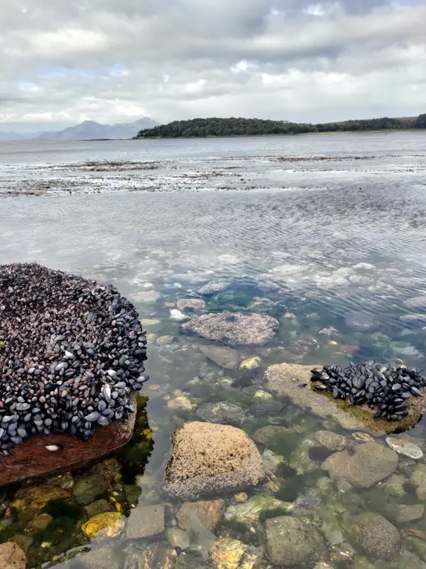
Both the archaeological features and the marine resources were easiest to survey at low tide. It was a very shallow area, so suddenly we had several extra metres of land when the water receded. Setting nets was also ideal and very straightforward at low tide—it was simply a matter of walking out, placing the net, and waiting for the water to rise again.
We managed to catch a few fish, which we prepared in a pit oven. We heated stones over the fire and then placed them in a pit in the sand, added leafy branches of coiüge, canelo and wild currant, placed the filleted fish skin-side down, and covered it with more branches. Then it was simply a matter of waiting about 30 minutes until the fish was ready. We ate it with potatoes and mashed sweet potato with plenty of garlic, along with wild celery and a flower salad whose name I unfortunately cannot remember. Very luxurious indeed!
Then came the day of our return journey. We had been told the day before that we would be picked up at around 10 AM. So we had breakfast, packed up camp, and were more than ready by 9:45. Then we waited… and waited and waited. Hour after hour. After four hours, we decided to make lunch, and after seven hours, we began to grow rather concerned. We had only managed to get in touch and were told they would be late - but not how late.
So how do you best spend seven hours in the wilderness waiting for rescue? Camp activities, of course. There was carving, playing music, singing, playing games, and working. Someone probably took the opportunity to have a nap as well. We were in no danger and had enough food for several more days.
But eventually, we saw a boat entering the bay - though not the one we had arrived in. We stood there staring, wondering if it was the “fifth member” we were seeing (a classic horror scenario where you start imagining things). But it was real - we were rescued by a whale-watching vessel. Fantastic! We were even given dinner, and the dolphins came to wave us off.
All’s well that ends well. Now all that remains is to enter the data and carry out the analyses.
3 March 2026: Off we go!
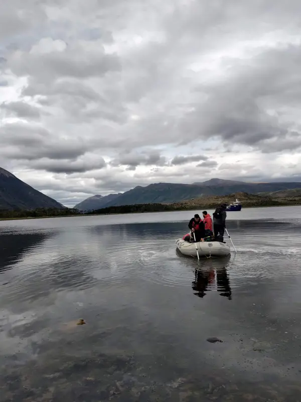
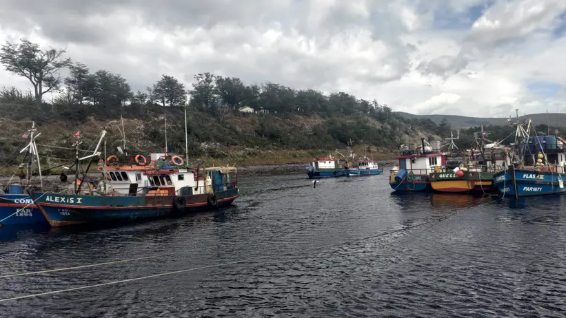
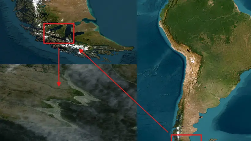
The taxi picked us up at 10 am and we headed towards the boat “Hurricane”, which would take us on the eight-hour journey around the Brunswick Peninsula. We rounded the southernmost point of the American continent and finally arrived at the area to be studied.
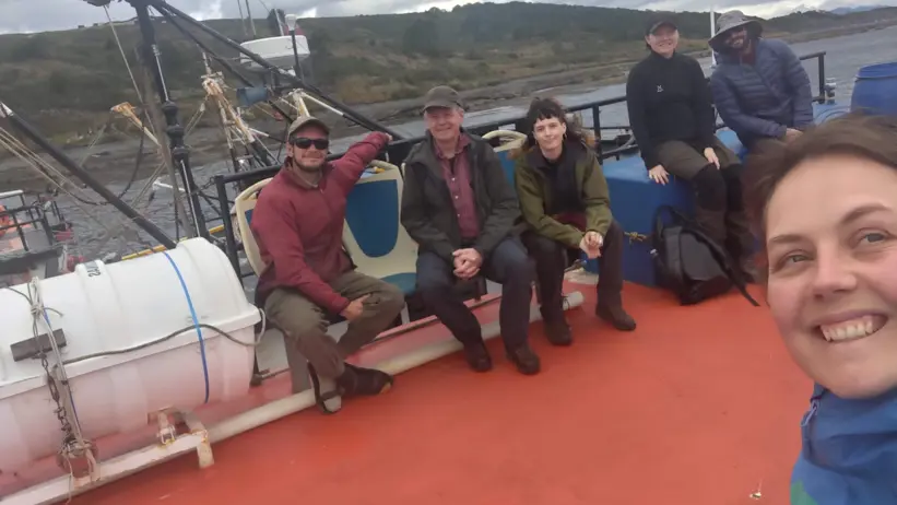
But who exactly is taking part in the fieldwork? I am responsible for planning the methods and will compile all the data we collect into my Master’s thesis, which will hopefully result in a scientific article: my supervisors Lars and Elle; archaeologist Robert from Spain; marine biologist Benja from Chile; field assistants Lollo and Sebba from Sweden and Chile respectively; and documentary filmmaker Mariano, also from Chile. So, a truly international and multidisciplinary team.
Also on board was a glaciology research team. It was around this point that we began to suspect something might be slightly odd. They were going to be out for 14 days and we for 10, yet we were supposed to travel back together. To be continued…
At around 8 pm, we were dropped off at the four headlands we were to study. We set up camp and then went to sleep.
The days began with porridge at 7.30, prepared by master chef Lars and served with homemade rhubarb jam made by Benja. Then the fieldwork really began!
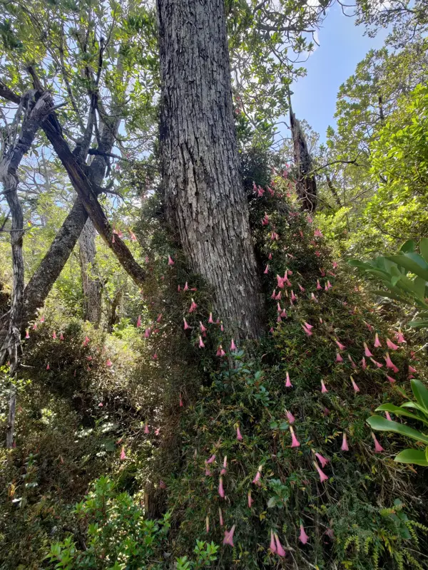
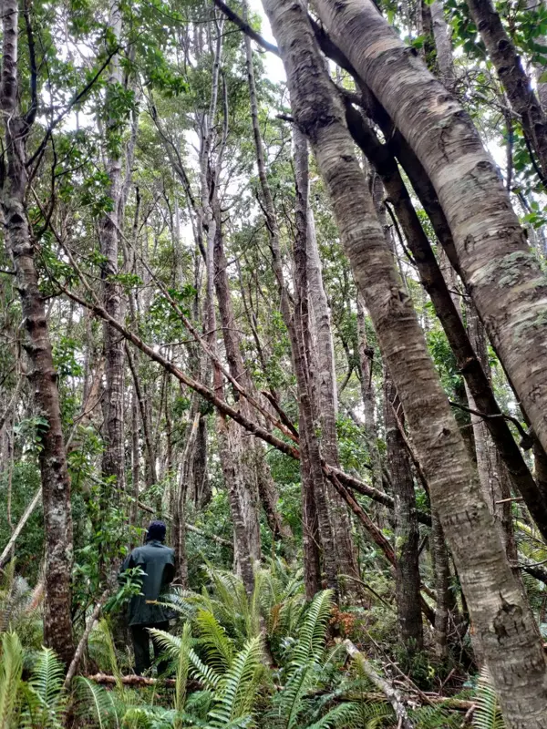
To assess forest structure, sample plots were established in which density, diameters, age, tree species composition and tree positions were recorded – easier said than done in a dense rainforest full of dead wood and thorny shrubs.
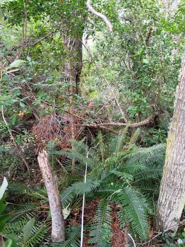
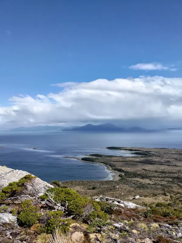
To locate all the bark-stripped trees, transects were carried out across each headland, with three people walking side by side and examining every tree. This, too, was easier in theory than in practice when you could only see about three metres ahead. You should have seen us crawling, climbing and squeezing our way through the forest! Simply emerging from the dense woodland into the bay, with the high mountains in the background, was enough to make you take an extra-deep breath.
We ate lunch together on the beach, sometimes with dolphins providing entertainment. An unexpected favourite lunch consisted of black beans, tuna, cream cheese and plenty of wild celery from the shoreline, quickly heated on the camping stove and wrapped in tortillas. It may not sound like much, but it was actually delicious – or perhaps it was just the outdoor factor?
13 February 2026: Preparing
During the autumn, I familiarised myself with various methods for describing forest structures in forests unaffected by forestry. It was an interesting question to reflect upon: how does one best describe a forest so that someone else can understand it and gain a sense of the place, if it does not fit into the templates of managed forests? In managed forests, there are well-established methods with different metrics that readily describe the forest to an informed reader. However, not all of these established measures are relevant in an unmanaged forest. Moreover, the method needed to be feasible to implement in the field; I cannot measure every tree and therefore have to make some form of selection. In the end, I settled on a number of parameters that I believed would work best. It remains to be seen whether they prove to be appropriate or not…
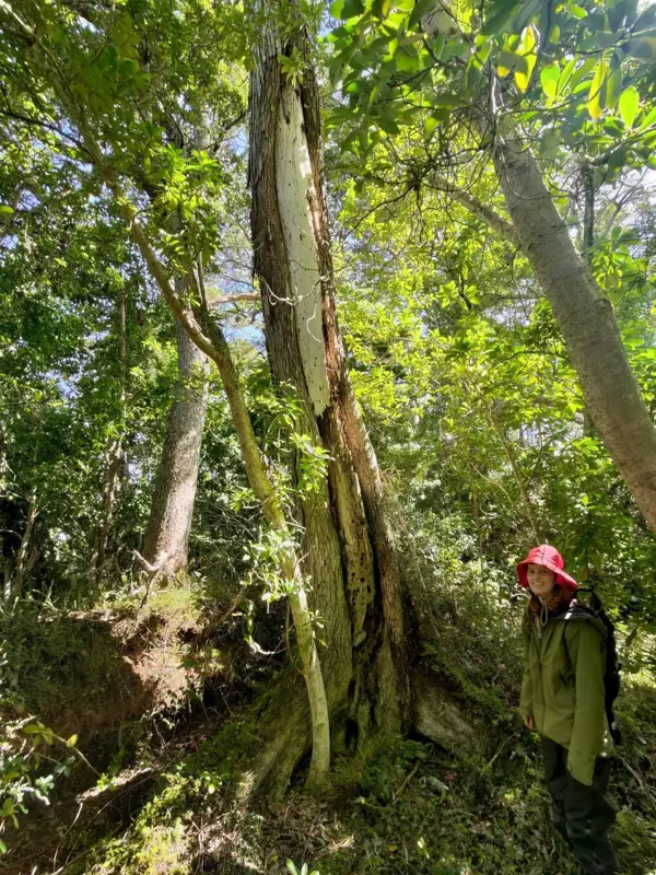
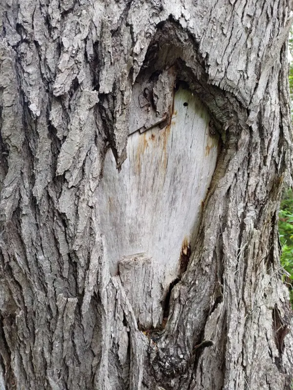
I also familiarised myself with cultural modified trees (CMTs), that is, trees bearing marks left by people. These may include traces of bark harvesting for making objects or obtaining food, smaller marks used to indicate paths, or marks created for ritual purposes. By dating and analysing the shape of the bark scars, I can determine when the bark was removed and what it was most likely used for. These trees are living archaeological and cultural remains that will disappear over time - something that has already begun to happen. It is therefore important to study them while they still exist. Deciduous trees are often more susceptible to rot, and in the humid climate decomposition is accelerated, which makes the task of dating the bark scars more difficult. Consequently, I also needed to develop a complementary method in addition to coring the trees, which is the conventional approach.
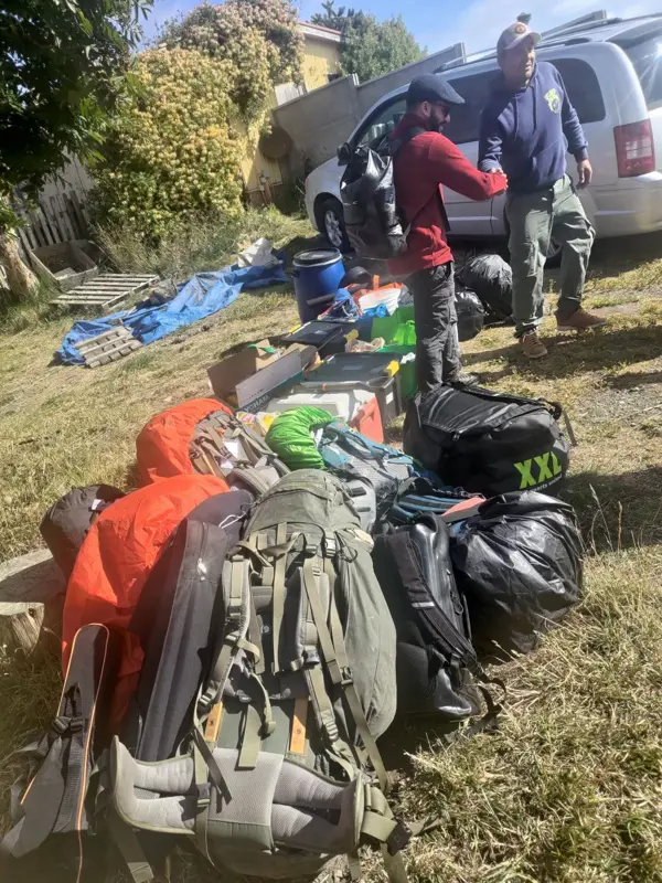
I also created numerous recording sheets for all the data to be collected. Travelling to southern Chile, into roadless terrain, presents the problem that it is impossible to return if I forget to measure something, or to obtain new equipment if anything is forgotten or breaks. Once in Punta Arenas, the final essential items of equipment were purchased. Most important of all, however, food! But how much do eight hungry fieldworkers eat over ten days? How much cake and coffee are required? How long will the food keep, and what is simple and enjoyable to cook over an open fire? It turned out to be a great deal of food…
19 January 2026: Hello!
My name is Klara Logård, and you are about to join me on my master’s project – to South America, and more specifically, Chile! I belong to the very first cohort of forestry science students in Umeå, and I have since completed the master’s programme Forest Ecology and Sustainable Management, also in Umeå.
The programme has been incredibly broad. Naturally, we have studied forestry, but just as much ecology, as well as some chemistry, economics, law, climatology, and everything in between. As students, we have truly been able to shape our own education through a wide range of elective choices. What I value most from the programme is everything we have seen and experienced during our trips and field excursions.
Now to my master’s project: I am writing a 60-credit thesis, which corresponds to a full academic year.
My thesis focuses on one of Chile’s Indigenous peoples, the Kawésqar, and their use of natural resources, with a particular emphasis on forests. They previously lived as nomads and travelled through the Strait of Magellan and the waters of southern Patagonia in canoes built from bark. The bark was taken from southern beech trees, many of which are still standing today. By dating when the bark was removed, I can determine when people lived in these areas and then attempt to reconstruct the forest structure.
To survive in these environments, they - like many other Indigenous peoples - developed advanced methods to make the best possible use of the resources available to them. My focus is on how both terrestrial and aquatic resources were used, and how this has influenced, and continues to influence, the forest. Why is this relevant, you might ask? At present, there is considerable discussion about how forests should be managed and about increasing the area of protected forest. Understanding and acknowledging that most forests considered “untouched” often bear traces of people who once lived in and depended on them - and that this affects the values these forests hold today - is crucial.
Even in the area we are travelling to - eight hours by boat from the nearest civilisation - these traces of human activity can be found, much like in the mountain forests of the Nordic region. It is therefore important to understand why forests look the way they do in order to preserve these values in the future. Another important aspect is to highlight and study ways of using forests that differ from what we take for granted in modern forestry. Perhaps we can learn something from people who have lived in and off the forest for thousands of years.
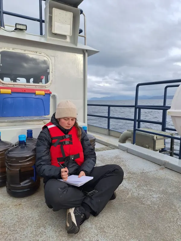
During the autumn term, I focused on familiarising myself with the area and developing a method for studying cultural remains and forest structure. My supervisors are Lars Östlund and Elle Eriksson. During January and February, we are conducting fieldwork in Chile, where I am currently sitting, looking out over the sea, and writing this text. During the remainder of the spring, I will compile all the data and focus heavily on writing.
It is now time to wrap up this blog post. In the next post, you will get to join us on our journey through Chile!