Land-use category
The land-use category indicates how the land is used. In the National Forest Inventory and the National Forest Soil Inventory, the land-use category determines whether and to what extent the sample plots are inventoried.
The results are based predominantly on information from sample plots on the land-use category forest land.
Classification of the land-use category
The classification of the land-use category is based on the condition of the land at the time of the inventory, without consideration of the potential for production‑enhancing measures. Nor should consideration be given to expected changes in land use as long as these have not yet occurred.
Productive forest land
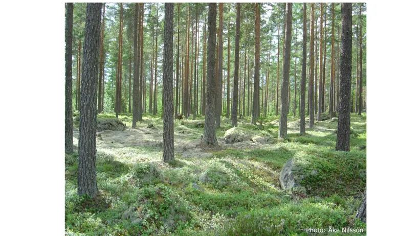
Photo: Åke Nilsson.
Land suitable for timber production and not used to any significant extent for other purposes. Land is considered suitable if it can produce, on average, at least 1 cubic metre of standing timber (m³sk) per hectare and year at a rotation age of 100 years (corresponding to site quality class VIII or higher according to Jonson, or H100 exceeding approximately 10 m according to the site index). Productive forest land includes extensively used pasture land and land within game enclosures that is not agricultural land. Productive forest land also includes abandoned agricultural land and other unused land suitable for forest production, unless forestry is clearly an unsuitable land use (for example, areas containing ancient monuments). Agricultural land that has not been cultivated during the past three years is considered abandoned and is transferred to productive forest land. So‑called conversion land, however, remains classified as arable land until the land use has changed. Plant nurseries and seed orchards are classified as built‑up land. Ornamental evergreen plantations and clear cases of Christmas tree plantations on former arable land are classified as arable land, as are energy forest plantations.
Semi-natural pasture
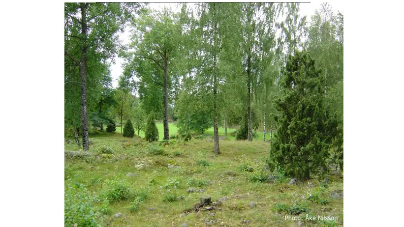
Photo: Åke Nilsson.
Land that is primarily used for grazing and is not regularly ploughed. The land‑use category is often characterised by tussocks, stones, some shrub vegetation, or high soil moisture.
Arable land
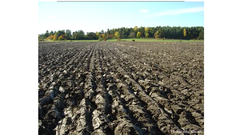
Photo: Åke Nilsson.
Land used for crop cultivation or grazing and that is regularly ploughed or managed through mowing. Arable land also includes adjoining areas where clearing for the arable land is carried out on a regular basis, as well as land used for the commercial cultivation of vegetables, fruit, berries, lawns, ornamental greenery, energy forests, and clear cases of Christmas tree cultivation on former arable land.
Mire
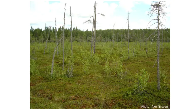
Photo: Åke Nilsson.
Wet land with usually peat-forming plant communities. However, the land does not need to be peatland in the sense that the peat depth exceeds 30 cm. Usually treeless or sparsely wooded. Site productivity according to Jonson is less than 1 m³sk per hectare and year. Mires include bogs and fens.
Rock and certain other impediments
Exposed bedrock, stony ground, shingle fields, shingle beaches (bare sand or stone beaches), the Alvar of Öland, and other similar land types where site productivity according to Jonson is less than 1 m³sk per hectare and year.
Mountain coniferous forest
A transition zone between productive forest land and the mountains. Site productivity according to Jonson is lower than 1 m³sk per hectare and year. The coniferous trees are unable to form closed stands but may occur in groups. Birch is normally crooked. Note that mountain coniferous forest must contain coniferous trees or at least stumps of such trees. If the forest near the mountains is pure birch forest without any significant presence of conifers (or stumps thereof), it is classified as mountain land if site productivity is less than 1 m³sk per hectare and year.
Mountain land
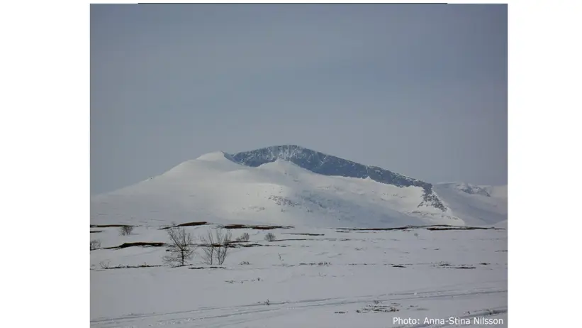
Photo: Anna-Stina Nilsson
Bare or sparsely wooded areas above the conifer tree line. Within mountain land, only the following land-use categories are recorded from other classes: productive forest land, mountain coniferous forest, and freshwater. The boundary between mountain coniferous forest and mountain land is characterised, among other things, by the following:
- If only birch extends up towards the bare mountain, the site productivity limit of 1 m³sk per hectare and year is decisive. As soon as the Jonson site productivity falls below this value, the land-use category is mountain land. This means that the lower boundary of the mountain land category lies lower when pure birch forest extends towards the mountains than when mountain coniferous forest occurs.
- If coniferous trees extend up towards the bare mountain, a mountain coniferous forest zone is distinguished as described above. Within the land-use category mountain land, only occasional, semi-prostrate, shrub-like individuals of pine and spruce may occur. However, solitary individuals of more robust coniferous trees may be present. Stumps indicating a previously more abundant occurrence of coniferous trees must not be present.
Other climatic impediment
Land located in Norrland, primarily on flat, moist sites. The land is not situated in terrain that can be classified as mountain land or mountain coniferous forest. The water surplus is not so pronounced that the land can be classified as mire. Due to a harsh climate, site productivity according to Jonson is less than 1 m³sk per hectare and year.
This land-use category is no longer used. However, in the frequency map for Other land, Other climatic impediment is included, as it constituted one of the 14 land-use categories during the inventory carried out in 1983–1987, which forms the data basis for the land-use frequency maps presented in MarkInfo.
Roads and railways
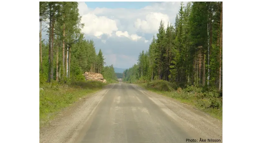
Photo: Åke Nilsson.
Roads are here defined as roads for permanent use with a minimum width of 5 metres. Roads include the carriageway, verges, ditches, parking areas, etc., as well as land where the forest is regularly cleared to maintain sightlines. Note that fitness trails with a width of at least 5 metres are also classified as roads.
Railways are defined as areas used for rail-bound traffic. A railway comprises a larger area than the track bed itself, namely the entire area where forestry cannot be carried out due to the presence of the railway. Such areas are often fenced, which facilitates boundary delineation.
Roads and railways located within, or along the edge of, arable land, mountain land, protected areas, military impediments, built-up land, or other land are classified as belonging to the respective adjoining land-use category.
Power line corridor within productive forest land
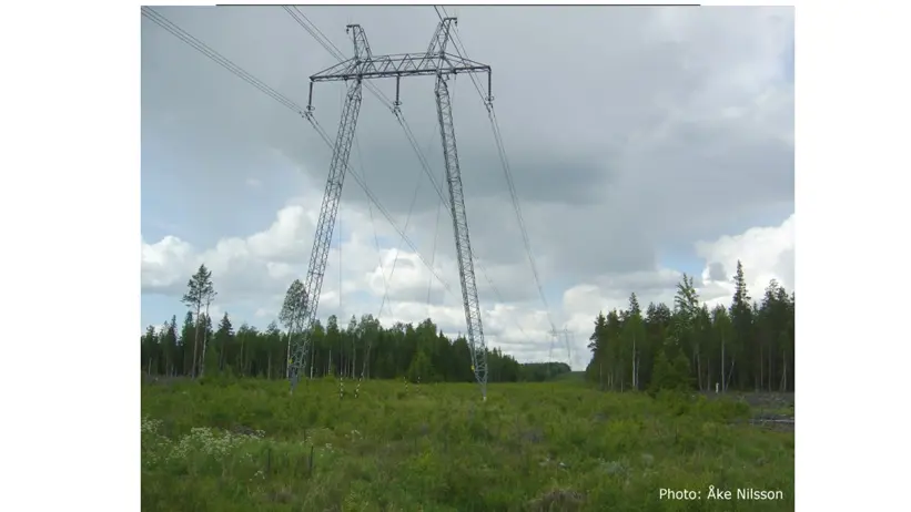
Photo: Åke Nilsson.
Corridors for electric power lines with a width of at least 5 metres that are located within land that would otherwise be classified as productive forest land. If the width does not exceed 5 metres, the corridor is classified as productive forest land. The boundary between the power line corridor and the productive forest land is defined by an imaginary straight line tangent to the tree trunks (or, if the stand has been felled, the stumps) on the forest land.
Protected area
Protected areas include national parks, state domain reserves, and certain other areas protected by other means, such as some nature reserves or parts of nature reserves, archaeological sites (excluding pitfall trap systems), and natural monuments.
This land-use category is no longer used. However, in the frequency map for Other land, Other climatic impediment is included, as it constituted one of the 14 land-use categories during the inventory carried out in 1983–1987, which forms the data basis for the land-use frequency maps presented in MarkInfo.
Military impediment
Military impediments include target areas within firing ranges and bombing ranges, as well as certain other military areas. Note, however, that areas—usually fenced—adjacent to military installations are classified as built-up land. Areas are classified as military impediments for safety or security reasons.
Built-up land
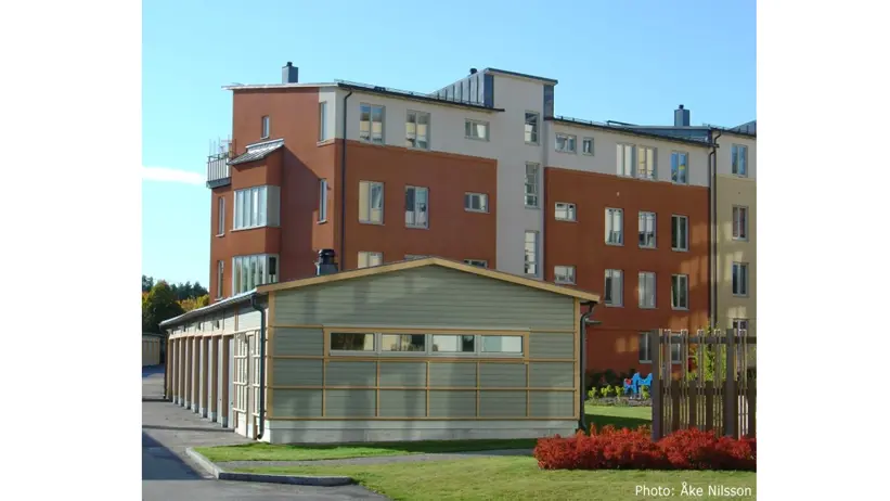
Photo: Åke Nilsson.
Built-up land includes urban areas – including parks – industrial areas, land associated with military installations (usually fenced), shooting ranges, golf courses and sports facilities, but excluding ski facilities (classified as other land) and illuminated fitness trails (classified as roads). It also includes facilities for outdoor bathing, airfields, plots and parks outside urban areas, garden facilities, seed orchards, plant nurseries, energy forest plantations, and clear cases of ornamental greenery cultivation and Christmas tree plantations.
Note that built-up land also includes other “land-use categories” (excluding water) and tree-covered areas where active forestry is not carried out, provided they are located within the types of land mentioned above.
Other land
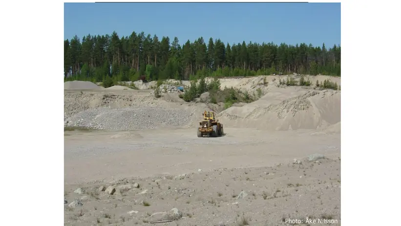
Photo: Åke Nilsson.
All land areas that are not assigned to the land-use categories described above. This category includes, for example, storage areas, rest areas, active gravel pits, peat extraction sites, and mines.
Freshwater
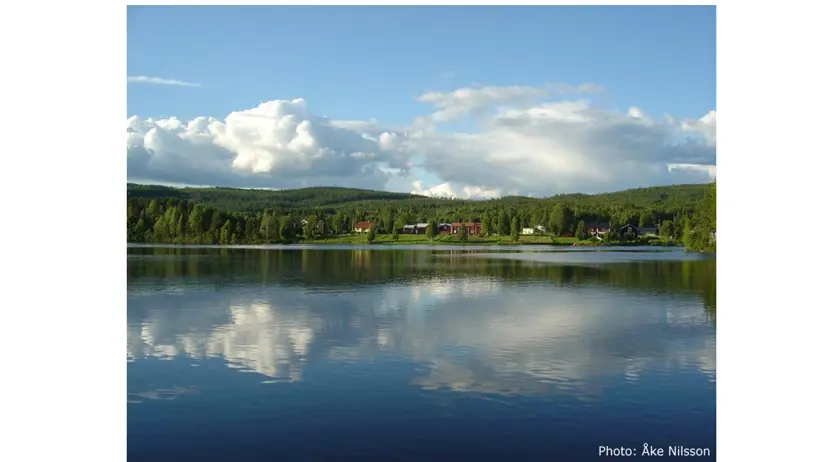
Photo: Åke Nilsson.
Lakes and watercourses of all kinds, including excavated canals, that are at least 2 metres wide, as well as ponds. Watercourses narrower than 2 metres are assigned to the adjacent land-use category. Freshwater also includes areas that—verified in the field—are located below the highest regulated water level.
Contact
-
PersonJohan Stendahl, head of department and researcherBiogeochemistry of Forest Soils