How to cite pictures, figures, tables and maps
Last changed: 11 March 2024
On this page you can read about how to write references to pictures, photographs, tables and maps using the SLU Harvard reference style. Remember to follow copyright restrictions when you use other people’s illustrations in your work.
When you include an illustration in your work you need to add a figure or table description in addition to the illustration. Figure descriptions are placed below the figure and table descriptions are placed above the table.
Keep in mind:
- The description should include an explanatory text that describes the figure/table. In addition, it should also include information about the origin of the illustration, to inform the reader where the illustration can be found and who the creator is.
- Every illustration needs to be mentioned in the text, to help the reader know when it is relevant to look at it.
- Always add a full reference to the illustration in your text if you did not create it yourself. You can either include the full reference in the figure or table description or add it to the list of figures or list of tables. A third option is to include the complete illustration references in your regular reference list.
If you are unsure of what practice is preferred at your department, please ask your teacher or supervisor.
When you use an illustration that you created yourself you need to make that clear to the reader. You can either add the information to the figure/table description or state on the title page of your work that “the illustrations are created by the author, unless otherwise indicated”.
Copyright
Pictures, figures, tables and maps that you have not created yourself for your text are copyright protected. To be able to use them you need the copyright holder’s permission. Another option is to use a copyright free illustration, where copyright has expired, or use an illustration with a Creative Commons license for example.
Examples for different types of sources
Illustration from the web or a database
In the examples below, there is a reference to the source in the figure description and a full reference in the reference list or the table of figures.
The figure description should include:
- An explanatory text that describes the figure.
- A reference to the source (creator and year).
Include, if available:
- Creator/organization
- Year
- Title
- What type of illustration it is i.e.[photograph]
- Available: Archive/Database (if the illustration is available in an archive or database)
- Link to the source
- [Date] when the illustration was obtained
The reference is written as follows:
Creator (Year). Title. [type of illustration]. Available: Archive/Database. Link [Date]
The illustration has a Creative Commons license
In figure 1 you can see an example of a photograph licensed with a Creative Commons license that allows you to use it for non-commercial purposes. When an illustration has a CC license you need to add a link to the license in the figure description or where you choose to state the full reference. In this example, the creator is a person.
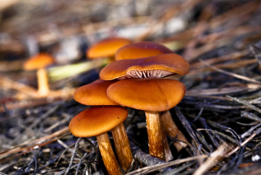
Figure 1. Mushrooms (ONeal 2009) (CC BY-NC-ND 2.0).
The full reference to figure 1:
ONeal, C. (2009). Mushrooms. [photograph]. https://flic.kr/p/7susWa (CC BY-NC-ND 2.0) [2020-02-13]
The illustration is used with the permission of the creator
In figure 2 you can see an example of a photograph taken by a person, where you have the creator's permission to use it in your text. It must be clear to the reader that you have this permission. You can clarify this in the figure description, in the table of figures, in the reference list or write it on your title page.

Figure 2. A ragdoll with blue eyes (Persson 2022).
The full reference to figure 2:
Persson, M. (2022). Frasse. [photograph]. https://flic.kr/p/2nnoXci [2022-05-25] Used with the copyright holder’s permission.
Illustration from a book, article or report
When the illustration is from another work you cite that source, as well as the page where the illustration can be found, instead of the illustration directly. The format of the full reference is depending on the type of source. You can read more about references to different sources on this page:
In the examples below, there is a reference to the source in the figure description and a full reference in the reference list or the table of figures.
The figure description should include:
- An explanatory text that describes the figure.
- A reference to the source (creator, year and page number).
The illustration creator is the same person as the source's author
Figure 1 shows how cells divide. The picture is from a book and its creator is the same as the author of the book.
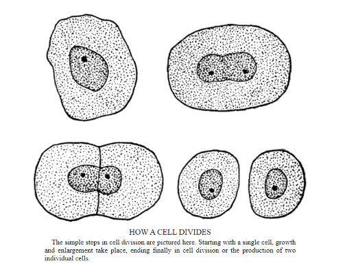
Figure 1: Cell dividing in simple steps (Burkett 1914:10).
You write the full reference based on the source type. In this example, the picture is from a book:
Burkett, C.W. (1914). The Farmer's Veterinarian. New York: Orange Judd Company https://www.gutenberg.org/files/55366/55366-h/55366-h.htm [2022-05-30]
The illustration creater is someone else than the source's author
Figure 2 shows a tree swallow. The picture is from a book and the creator of the picture is someone else than the author of the book. In this case the creator of the picture should be named in the figure description, instead of the author of the book.
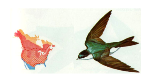
Figure 2. Tree swallow (Singer 1977:61).
You write the full reference based on the source type. In this example the picture is from a book where the authors are not the creators of the picture. You write the reference as if it was a book chapter:
Singer, A. (1977). Tree swallow [drawing]. In: Scott, V.E., Evans, K.E., Patton, D.R. & Stone, C.P. (eds) Cavity-Nesting Birds of North American Forests. Washington: Forest Service U.S. Department of Agriculture https://www.gutenberg.org/files/49172/49172-h/49172-h.htm [2022-05-30]
Tables
When you use a table in your work, you need to include a table description that explains the content directly above it. The text should also contain a reference to the table to provide context. The reference can for example be written like this:
Usage of water is likely to decrease further (Table 1) in the following years.
If you use someone else’s table, you need to be aware of any copyright restrictions. If you only use the data, but create the table yourself, you only need to cite the source.
In the example below, there is a reference to the source in the table description and a full reference in the reference list or the table of figures.
The table description should include:
- An explanatory text that describes the table.
- A reference to the source (creator, year and page number).
Table 1. Singapore’s domestic household water consumption (Rowe & Hee 2019:59) (CC BY 4.0)
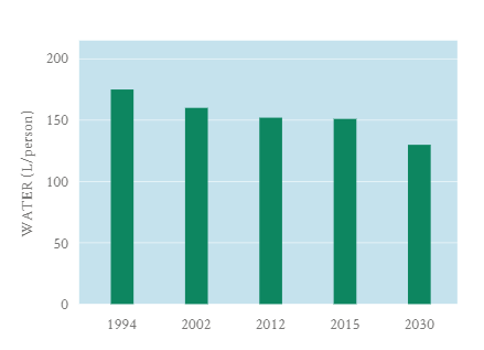
You write the full reference based on the source type. In this example the picture is from a book:
Rowe, P.G. & Hee, L. (2019). A City in Blue and Green : The Singapore Story. Singapore: Springer https://link.springer.com/book/10.1007%2F978-981-13-9597-0 (CC BY 4.0) [2020-03-16]
Maps and geodata
Maps are copyright protected and you need to follow copyright restrictions if you want to use a map in your work. If you’ve used a map and added information about roads, buildings, bodies of water etc (geodata) you need to cite both the map and the geodata.
You can draw your own map without needing any permissions. If you copy a map or change only details, you may be in danger of plagiarizing. If you use someone else’s map you need the creator’s permission (unless it’s free to use).
SLU has an agreement with the Swedish Land Survey (Lantmäteriet) that gives students and employees at SLU the right to use their digital maps, both current and historical, in their works and publications. You have access to digital maps and geodata from several sources, as well as historical maps.
How to cite dynamic digital maps
It is hard to give an example of a generic reference, since maps can be created using many different online tools. The most important aspects are that you follow copyright rules and cite the map in a way that gives the reader enough information about where you got the map, and to possibly recreate it.
Write in the reference, if possible:
- Publisher
- Year
- Details of the map, i.e. coordinates or place
- Format/dataset
- [Map]
- Link to the map
- Date of map creation
Publisher (Year) Details. Format/dataset [Map] Link [Date]
Example of a reference to a dynamic digital map:
Swedish Land Survey (2020) Alnarp. SWEREF 99 TM, RH 2000. Aerial photograph [Map] https://minkarta.lantmateriet.se [2020-05-11]
Students and employees at SLU have the right to use maps from the Swedish Land Survey, SGU, SCB or the Swedish Maritime Administration in their works and publications. If you use those maps, include the following text in your work:
Data source/map name © Name of administrative authority
Different map tools have different user terms. Find out what restrictions that might apply to the map you have created:
How to cite geodata
Wikipedia defines geodata as a “series of standards as data and information having an implicit or explicit association with a location relative to Earth”.
It is hard to give an example of a generic reference, since geodata can be obtained using different tools. The most important aspects are that you follow copyright rules and cite the data in a way that gives the reader enough information about where you got the data, and possibly to recreate it. Make sure to check what copyright restrictions apply to the data you’re using.
- The Swedish Land Survey (Lantmäteriet) guide on how to cite their maps and geodata (in Swedish, PDF)
How to cite a printed map
Write in the reference, if possible:
- Creator/organization
- Year
- Title
- [Map]
- Edition (if more than one exists)
- Scale
- Place of publication
- Publisher
- Series
Creator (Year) Title. [Map]. Scale. Place of publication: Publisher
Lantmäteriverket (2003). Topographic map produced for Swedish Armed Forces to be used for national and multinational exercises. [Map] 1:50 000. Gävle: Krigstryckningsorganisationen (KTO).
If the printed map is published online, add:
- Link
- [Date] when the map was obtained
How to cite historical maps
Historical maps often lack information about author, publisher and year. In these cases you can choose to reference them in the following way: Provide the map details you have, archive and file designation. Map details can include the name of the map, geographical area such as parish and county, surveyor, scale and year.
Common archives in Sweden are Lantmäteristyrelsens arkiv (LMS), Lantmäterimyndighetens arkiv (LMM) and Rikets allmänna kartverks arkiv (RAK). If you have viewed the map online, you can include the link and date when you downloaded the map.
Include, if available:
- Details, showing what is mapped, when it was made, etc.
- Archive
- File designation
- Link
- Date
The reference is written as follows:
Details. Archive, File designation. Link [Date]
Example of full reference:
Storskifteskarta över Luttra, Luttra socken, Skaraborgs län 1775. Lantmäteristyrelsens arkiv, P137-3:1.
Contact
SLU University Library
library@slu.se, 018-67 35 00
Addresses and opening hours