Department of Forest Resource Management

Call for proposals: management plans for urban forests, parks and green spaces
Would you like to help shape the future of greener, healthier cities? The COST Action network invites municipalities across Europe to submit their management plans for urban forests, parks and green

Dissertation Léna Gozé
Making better use of sample data: estimation of plant abundance and associated uncertainties charlotta.bergstrom@slu.se Léna Gozé defends xer thesis "Making better use of sample data: estimation of
Forestry for students without a forest education
PhD course: Forestry for students without a forest education dimitris.athanassiadis@slu.se Forests are increasingly prominent in public and political discourse, with concerns about climate change,
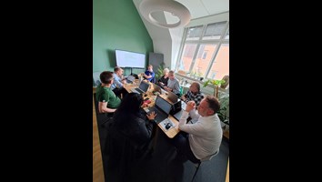
From Planning to Action: Building the Future of Urban Forestry
In a recent Makeathon organized in Malmö under the COST Action European Network for the Integrative Approach of Urban Forestry (INTUF), researchers and urban forestry experts came together to design
10 new research partnerships to advance sustainable forest management granted
Ten doctoral projects have been granted within WIFORCE – Wallenberg Initiatives in Forest Research program at SLU. The projects are conducted in collaboration with private and public partners and aim
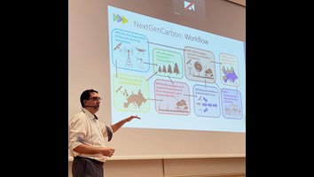
Kolbalanser i olika typer av landskap: Stort SLU-samarbete med världsledande klimatforskare ska ge säkrare data
A new EU- funded project aims to improve our understanding of the European greenhouse gas budget through innovative modelling of the land-based carbon cycle. The new models created by the project
Dissertation Ulrika Roos
Ground lichen development and consultation between reindeer husbandry and forestry : the past, present and future of samråd in Sweden charlotta.bergstrom@slu.se Ulrika Roos defends her thesis "
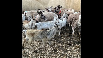
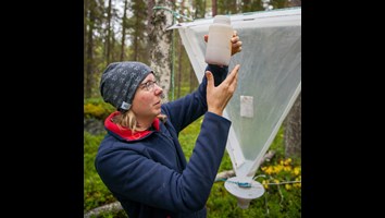
EQUIP
The purpose of EQUIP is to monitor the survival and mortality of reindeer calves in cooperation with reindeer husbandry in order to find causes of losses of calves from calf marking to slaughter. In
Expands with new analyst
Teresa López-Andújar Fustel is SLU Forest Damage Centre's newest addition - she takes on the role of analyst in the field of wind and snow. With this addition, the centre expands its analysis
Projects
Projects at Forest Remote Sensing AuroraSpace - Boosting Space Business Developing hyperspectral drone imagery for improved monitoring of forest insect damages Developing remote sensing to map
Methodology aerial image inventory
pernilla.christensen@slu.se
Drones
pernilla.christensen@slu.se