Floodplains
Last changed: 30 April 2022

Floodplains have been quite common in the past. Constructions and intensive measures in agriculture and forestry have reduced their number. Restoration of floodplains and re-connection to the river aims to increase the retention capacity and ecosystem functioning. Floodplains can be natural or man-made.
A floodplain is a nearly level land along a stream flooded only when the streamflow exceeds the water carrying capacity of the stream. Flood plains are naturally very fertile due to the river sediment which is deposited there and therefore they are good for cultivation. Nowadays, often the objective is to restore floodplains, their retention capacity and ecosystem functions by reconnecting them to the river. The floodplain cuts peak flows and prevents flooding. Ramp collapses are reduced since sediments partly settle into the vegetation at high flows. Flood plains also improve the durability of ramps of the stream. Bottom drift of sediments can be further reduced by making bottom dams. In floodplains, the complexity of the riverbed can be increased or maintained, which promotes natural recovery. Floodplains can form naturally around rivers of any kind or size. Even relatively straight stretches of river are found to be capable of producing floodplains.
In some situations, the riverbed does not need restoration measures at all or restoration can be carried out, for example, by a combination of a floodplain and a low water stream and bottom dams, loosening the riverbed edges or expanding the riverbed into sedimentation basins and wetlands. Slow-flowing water reduces bed erosion and allows water to remain stationary during periods of low water.
Localisation and implementation
The floodplain is e.g. suitable for situations where a river/ditch has become silted up through deposition of sediments. In this case, a narrow, meandering low water stream/ditch is dug into the vegetation at the bottom of a wide stream. During floods, the rest of the riverbed acts as floodplains where growing vegetation binds both solids and nutrients. The operation of floodplains can be improved by construction of hedges to break flood streams, e.g. hedges perpendicular to the river flow that are planted in the restored floodplain to slow down floods.
-
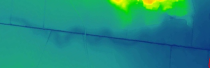
Digital elevation map showing a drainage channel (straight blue line) and the probable extent of the natural water course.
1/1

Effects, duration and maintenance
The trees growing along the riverbed and the herbaceous vegetation that binds the riverbed ramp are worth saving because the vegetation and the roots of the trees act as a natural erosion protection. Thus, the structure of the stream banks is more durable and the need for maintenance can be reduced. The problem is the determination of the height of the flood plain and how to make the crop grow quickly on ramps and plain. It is advisable to transfer vegetation to the plain. In agriculture, the areas can be sown with oats or grass. The plain is compacted with a bucket. The effect is long-term. After incorporation, maintenance includes taking care of the condition of the vegetation and from time to time it must be ensured that not too much sediment accumulates on the plain.
Floodplains - extended description
Definition
A floodplain is a nearly level land along a stream flooded only when the streamflow exceeds the water carrying capacity of the stream. Floodplains are naturally very fertile due to the river sediment which is deposited there and therefore they are good for cultivation. The floodplain cuts peak flows and thus prevents flooding. Ramp collapses are reduced since sediments partly settle into the vegetation at high flows. Floodplains also improve the durability of ramps of the stream. Bottom drift of sediments can be further enhanced by making bottom dams.
Nowadays, often the objective is to restore floodplains, their retention capacity and ecosystem functions by reconnecting them to the river. In floodplains, the complexity of the riverbed can be increased or maintained, which promotes natural recovery. Floodplains can form naturally around rivers of any kind or size. Even relatively straight stretches of river are found to be capable of producing floodplains.
The main goal of natural flood control solutions is to reduce and delay the surface runoff. Examples related to the prevention of floods include the restoration of natural floodplains and the enhancement of the naturalness of the river through rehabilitation. These types of measures are particularly suitable for river sites, as they increase the flow area and slow down the flow. In particular, the ability of floodplains to store higher than normal amounts of water is enhanced when their vegetation slows down the flow. In addition, vegetation in floodplains or river basins collects sediments carried by the flow. The layered sediments of many floodplains can create important aquifers. Clay, sand, and gravel filter water as it seeps downward. Water purification systems often take advantage of this natural phenomenon in a process called bank filtration.
Many floodplain meadows may even be dependent on the nutrients thus obtained (EEA, 2019). On the other hand, retaining water, for example in areas below fields, can prevent nutrients from entering the water body and thus improve water quality. In areas where floods and droughts are risk factors, water retention measures are particularly beneficial, for example for groundwater resources and agriculture.
One of the very effective ways of disconnecting floodplains from rivers is through drainage. Drainage reduces the water retention capacity of floodplain soils, which benefits agricultural yields but at the detriment of wetland habitats and water retention. Drainage is widespread across northern Europe (EEA, 2019). Of course, land drainage is needed in clay soils, for example, but it would be possible to assess whether the current drainage is too effective and could be reduced.
In some situations, the riverbed does not need restoration measures at all or restoration can be carried out, for example, by a combination of a floodplain and a low water stream and bottom dams, loosening the riverbed edges or expanding the riverbed into sedimentation basins and wetlands. Slow-flowing water reduces bed erosion and allows water to remain even during periods of low water.
Localisation and implementation
Floods are a common and quite damaging natural disaster and climate change is expected to increase the risk of floods. In the Baltic Sea region, the risk of flooding has increased due to factors such as urbanization, intensification of agriculture and changes in forestry. Denmark, Poland, Germany and Sweden have the most experience with natural water retention measures (NWRM) one example of which is floodplains. Different types of floods should be taken into account, but at present NWRM measures have focused on small-scale stormwater floods, not so much for agricultural land. Anyway, all NWRM measures should be implemented on a large scale to have an impact on flood risk management (Parjanne & Marttunen, 2021).
The floodplain is e.g. suitable for situations where a river/ditch has become silted up through deposition of sediments. In this case, a narrow, meandering low water stream/ditch is dug into the vegetation at the bottom of a wide stream. During floods, the rest of the riverbed acts as floodplains where growing vegetation binds both solids and nutrients. The operation of floodplains can be improved by construction of hedges to break flood streams, e.g. hedges perpendicular to the river flow that are planted in the restored floodplain to slow down floods.
Effects, duration and maintenance
The trees growing along the riverbed and the herbaceous vegetation that binds the riverbed ramp are worth saving because the vegetation and the roots of the trees act as a natural erosion protection. Thus, the structure of the stream banks is more durable and the need for maintenance can be reduced. The problem is the determination of the height of the flood plain and how to make the crop grow quickly on ramps and plain. It is advisable to transfer vegetation to the plain. In agriculture, the areas can be sown with oats or grass. Typically the plain is compacted with a bucket. The effect is long-term. After incorporation, maintenance includes taking care of the condition of the vegetation and from time to time it must be ensured that not too much sediment accumulates on the plain.
Some of the benefits of floodplains to a functioning natural system include:
- Fish and wildlife habitat protection.
- Natural flood and erosion control.
- Surface water quality maintenance.
- Groundwater recharge.
- Biological productivity.
- Higher quality recreational opportunities (fishing, bird watching, boating, etc.)
River restoration requires public support, investment and time. EU and national funding instruments are available to support restoration. EU WFD policy assumes that diffuse nutrient pollution and hydromorphological pressures are reduced where floodplains are more natural. Moreover, floodplains support achieving good quantitative status of groundwater. The buffer capacity of floodplains minimises extreme groundwater fluctuations during floods and groundwater reservoirs recharge with flood waters from the river overflowing on to the floodplain. EU Habitats and Birds Directives assume that increased area of natural floodplains is likely to improve conservation status assessments of listed habitats and species. However, an analysis of the conservation status of 37 floodplain habitats listed in the Habitats Directive shows that the vast majority are in either inadequate or bad conservations status. Across Europe, only 14 % of floodplain habitats and species are in good conservation status ((Parjanne & Marttunen, 2021).
The water protection effects of floodplains are difficult to assess through experimental research. Measurements should be made long before and after, so that, for example, sediment retention and changes in water quality can be assessed.
Challenges
Extensive cooperation is needed in holistic planning of floodplains. The effects of runoff retention on floods are often small and not possible to realize in all water bodies. The effects on water quality (incl. harmful substances and microplastics) are still largely incomplete. Land ownership challenges are often an obstacle to the implementation of measures along watercourses and along the coast (Parjanne & Marttunen, 2021).
Floodplains - links to resources
Pamphlets, reports, videos and websites
EEA. 2019. Floodplains: a natural system to preserve and restore. EEA Report No 24/2019. Link
Kinnunen, O., Hjerppe, T. & Väisänen S. 2020. ELY-keskusten näkökulma luonnonmukaisten periaatteiden toteutumiseen maatalouden peruskuivatushankkeissa. Shared Waters-project report. ELY centers' perspective on the implementation of nature-based principles in agricultural dredging projects. 8 p.
Parjanne, A., Marttunen, M. 2021. Luonnonmukaiset tulvariskien hallintaratkaisut Itämeren alueella. Suomen ympäristökeskuksen raportteja 3, Natural flood risk management solutions in the Baltic Sea region (abstract in English).
Video on Youtube - What is a floodplain?
Wikipedia - Floodplain
Scientific papers
Västilä, K., Karttunen, K., Koskiaho, J., Kuussaari, M., Lehtoranta, V. & Väisänen, S. 2021. Nature-based solutions for climate change adaptation and water pollution in agricultural regions. Sustainability (submitted).
Västilä, K. & Jilbert, T. 2021. (manuscript in preparation).
DeZiel, B., Krider, L., Hansen, B., Magner, J., Wilson, B., Kramer, G. & Nieber, J. 2019. Habitat Improvements and Fish Community Response Associated with an Agricultural Two-Stage Ditch in Mower County, Minnesota. Journal of the American Water Resources Association 55(1): 154–188. DOI
Paradis, A. & Biron, P.M. 2016. Integrating hydrogeomorphological concepts in management approaches of lowland agricultural streams: Perspectives, problems and prospects based on case studies in Quebec. Canadian Water Resources Journal / Revue canadienne des ressources hydriques, 42(1): 54–69. DOI
Västilä, K., Järvelä, J. & Koivusalo, H. 2016. Flow–vegetation–sediment interaction in a cohesive compound channel. Journal of Hydraulic Engineering 142(1): DOI
D'Ambrosio, J.L., Ward, A.D. & Witter, J.D. 2015. Evaluating Geomorphic Change in Constructed Two-Stage Ditches. Journal of the American Water Resources Association 51(4): 910–922. DOI
Mahl, U.H., Tank, J.L., Roley, S.S. & Davis, R.T. 2015. Two‐Stage Ditch Floodplains Enhance N‐Removal Capacity and Reduce Turbidity and Dissolved P in Agricultural Streams. Journal of the American Water Resources Association 51(4): 923–940. DOI
Author:
Sirkka Tattari, Finnish Environment Institute (SYKE), Finland.
Contact:
Jari Koskiaho, Finnish Environment Institute (SYKE), Finland. e-mail