SLU Forest Map
Raster maps with information about Sweden’s woodlands and forests such as volume and tree species. These multi-purpose maps can be used for research, environmental monitoring and assessment and forest planning.

Comprehensive, highly detailed information
The 2015 SLU Forest Map contains a number of raster maps created by co-processing field inventories from Sweden’s National Forest Inventory (SLU), surface models from the Land Survey’s stereo-matched aerial photographs, and satellite images from Sentinel-2.
Each raster map cell (12.5 x 12.5 metres) describes the volume per tree species, basal area with mean height, basal area with mean diameter, and biomass. The volume maps provide an idea of the timber resources categorised by pine, spruce, beech, oak, birch, and other deciduous trees.
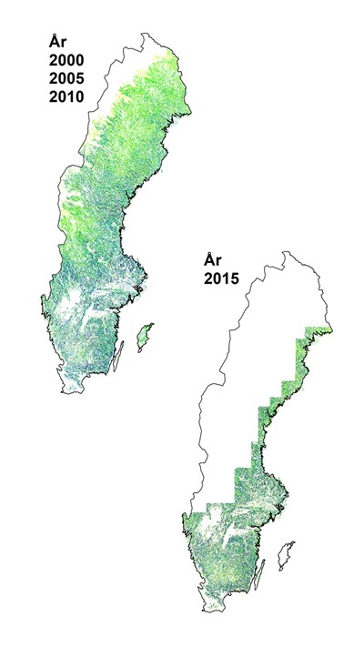
Three national maps containing information about Sweden’s woodlands and forests are already available. These maps include data collected in 2000, 2005 and 2010, each with cells of 25 x 25 metres. Up until 2010, the maps were based solely on satellite images from Landsat and SPOT.
SLU Forest Map has been developed and produced by the Division of Forest Remote Sensing at the Department of Forest Resource Management, SLU Umeå.
Image: Geographic expansion of the SLU Forest Map in 2000, 2005, 2010, and 2015. The 2015 expansion of the SLU Forest Map was limited to areas where high-resolution images were available.