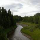
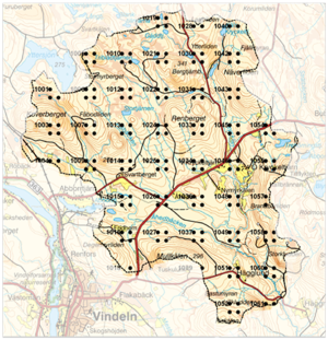
The Svartberget catchment
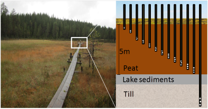
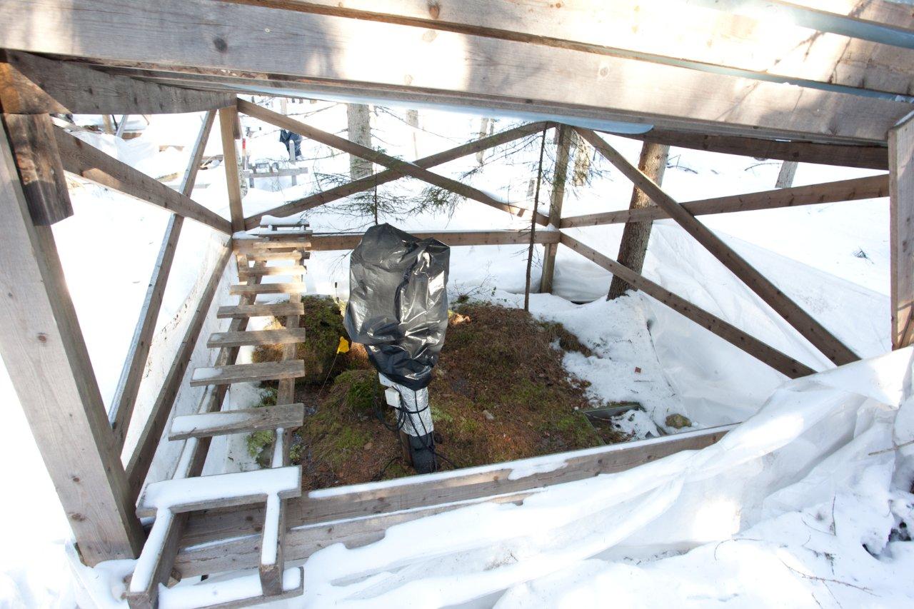
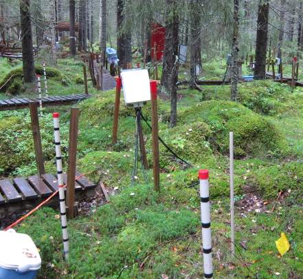
The catchment (50ha) with many names (Svartberget, Nyänget, SVW, site 7) is where it all began in 1979. It is also the heart of much of the current research on the contrasting hydrological and biogeochemical behavior of forested and mire catchments. The Svartberget catchment also hosts the first soil experimental and monitoring sites that begun in 1997, including the S-transect and the Russian wells.
Krycklan and landscape biogeochemistry
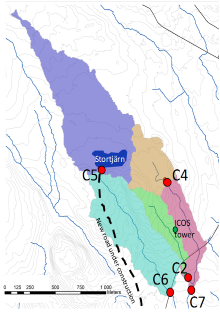
Recognition of the need to work at the landscape scale when addressing the influence of climate on aquatic ecology led to expansion of the 50 ha Svartberget catchment to the 6800 ha Krycklan catchment. This has led to a broadening of both the fundamental research questions and the management issues that are being addressed.
 |
|
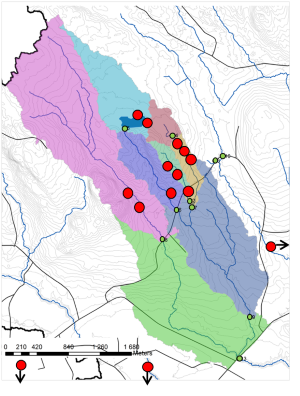
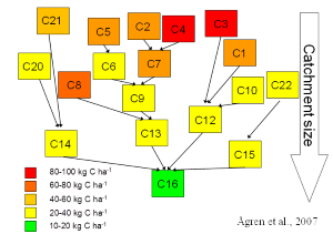
Annual export of DOC from the different sub-catchments in Krycklan. Note that the export of DIC can be as large, or even larger.
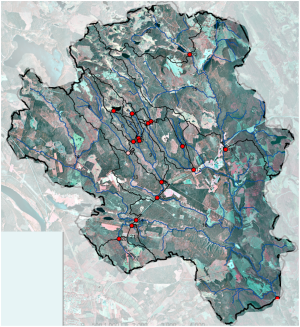
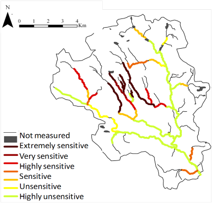
Here you can also observe how the streams are connected.
|
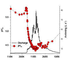
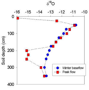
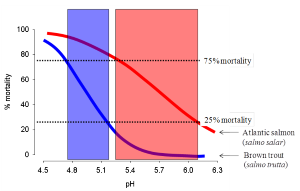
Decline of pH during the spring flood at C7. This decline is mainly driven by natural processes caused by increases in the concentration of DOC (dissolved organic carbon).
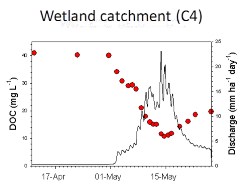
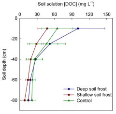
The contrasting behavior of DOC between the forested catchments and wetland dominated catchments.
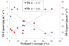
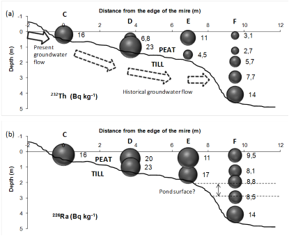
The contrasting behavior of different elements in the landscape depends on 1) Its affinity to organic matter and 2) the primary source of the element. For the examples above, thorium (Th) and lead (Pb) the affinity to organic matter are similar but whereas thorium is a weathering product, lead originates mainly from deposition.
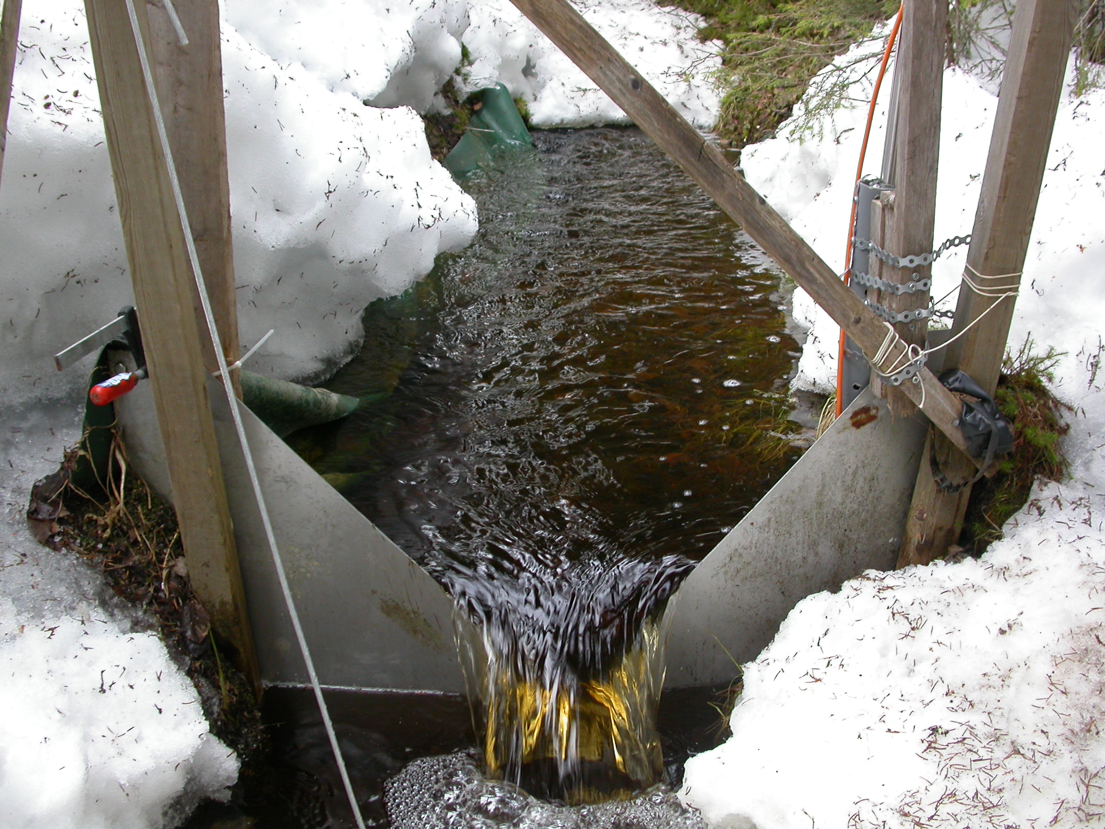
Stream water- regular
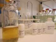
The 19 streams included in the regular program are sampled approximately 25 to 30 times a year, twice a week during spring flood, once a month during winter conditions and every second week, during the rest of the year. Standard analysis program includes;
- DOC
- Absorbance spectra
- pH
- O-18
- Archive sample
- CO2
- Cations, Anions
- DIN
During some years several additional samplings has been included to this regular program; Hg, REE, fluorescence, suspended material, isotopes, LMW DOM and bioassays.
Stream water - survey
During at least 5 occasions a larger number of streams (50-90) have been sampled, these streams are spread in the whole Krycklan Catchment. Some surveys have only focused on discharge while other has also included water chemistry or ecology. The chemistry avaliable from the survey includes TOC, cations, anions, pH and absorbance spectra.
Key references
Jansson, M., et al. (2012). Bioavailable phosphorus in humic headwater streams in boreal Sweden. Limnology and Oceanography, 57, 1161–1170.
Bergknut, M., et al (2011). Atmospheric deposition and retention of dioxins and PCBs in a pristine boreal catchment. Environmental Pollution, 159, 1592-1598.
Lidman, F., et al. (2011). Selenium dynamics in boreal streams: The role of wetlands and changing groundwater tables. Environmental Science and Technology, 45, 2677-2683.
Köhler, S.J., et al. K. (2008). Intra- and interannual variability of total organic carbon in two contrasting boreal landscape elements. J. Geophysical Research-Biogeosci. 113, G03012.
Bishop, K., et al. (2008). Aqua Incognita: The Unknown Headwaters, Hydrological Processes, 22, 1239-1242.
Laudon, H. et al. (2004). Seasonal dependency in DOC export from seven boreal catchments in northern Sweden. Aquatic Sciences. 66, 223-230.
Bishop, K., et al. (2000). Separating the natural and anthropogenic components of spring flood pH decline: A method for areas that are not chronically acidified. Water Resources Research, 31, 1873-1889.
Laudon, H., et al. (2011). Patterns and Dynamics of Dissolved Organic Carbon (DOC) in Boreal Streams: The Role of Processes, Connectivity, and Scaling Ecosystems, 14, 880-893
Bergknut, M. et al. (2010) Modelling the fate of hydrophobic organic contaminants in a boreal forest catchment: A cross disciplinary approach to assessing diffuse pollution to surface waters. Environmental Pollution, 158, 2964-2969.
Wallin, M. et al. (2010) Temporal and spatial variability of dissolved inorganic carbon in a boreal stream network – concentrations and downstream fluxes, J. Geophys. Res.-Biogeo. 2009JG001100.
Björkvald, L. et al. (2008). Hydrogeochemistry of Fe and Mn in small boreal catchments: The role of seasonality, landscape type and scale. Geochem. Cosmoch. Acta 72, 2789-2804.
Berggren, M., Laudon, H. and Jansson, M. (2007). Growth and respiration of freshwater bacteria on organic carbon from different terrestrial sources, Global Biogeochemical Cycles, 21 (4): doi:10.1029/2006GB002844.
Ågren, A., et al. (2007). Importance of seasonality and small streams for the landscape regulation of DOC export. J. Geophys. Res.-Biogeo, 112, G03003.
Buffam, I., et al. (2007). Landscape-scale variability of acidity and dissolved organic carbon during spring flood in a boreal stream network. J. Geophys. Res.-Biogeo. 112, G01022