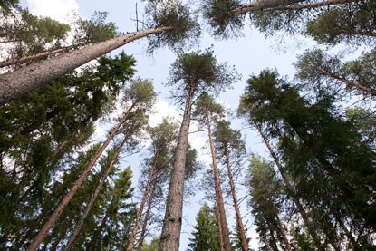
Single projects, long-term field experiments, and demonstration sites are registered in the national database SilvaBoreal. SLU as a whole has more than 2 000 forest field experiments, spread all over Sweden.
Svartberget Experimental Forest
Svartberget Experimental Forest was established in 1923 and covers more than 1 000 hectares. It is located seven kilometers northwest of Vindeln community. The major habitat is defined by elevation ranges from 160 to 320 meters above sea level and a mixed conifer forest. The bedrock is composed almost entirely of gneiss, and the soil is dominated by moraines of various thicknesses.
In the southeast, there is a large flat area called Åheden which is situated 175 meters above sea level and consists of sediments of sand and fine silt.
Kulbäcksliden Experimental Forest
Kulbäcksliden Experimental Forest was established in 1923 and covers 1 500 hectares. The experimental forest is situated where the Vindel River and the Ume River begin to part, eleven kilometers west-southwest of Vindeln. The elevation there ranges from 160 to 320 meters above sea level and the forest is completely dominated by Scots pine and Norway spruce.
From 1927-1958, Professor Lars Tirén was the scientific director of the experimental forests. His interest in questions about forest regeneration led him to start up a large number of regeneration experiments at Kulbäcksliden, many of which remain today.
He also thoroughly described Kulbäcksliden from a historical perspective and, in 1937, published the academic work: Skogshistoriska studier i trakten av Degerfors i Västerbotten.
The Degerö mire is situated within Kulbäcksliden Experimental Forest.
Ätnarova Experimental Forest
Ätnarova Experimental Forest was established in 1961. It covers 3 500 hectares and is situated 23 kilometers southwest of Gällivare municipally. To the southwest, the experimental forest borders Muddus National Park. The research site is quite high, located at an elevation of between 430 and 540 meters above sea level. The dominate forest types are old, sparsely distributed pine forest, “Norrland fir”, or birch stump shoots from cuttings made in the 40s.
Research at Ätnarova addresses forest management problems in montane forests where ecosystems are strongly affected by climate.
