Contact
Mats Nilsson, Professor
Soil Biology Unit, SLU
mats.b.nilsson@slu.se, +4690-786 8375, +4670-688 4409
On this page you will find directions to select infrastructures on the Degerö-mire.
Take a right when you leave the parking-lot at SLU and follow the road, take a left in the intersection and another left in the following roundabout. Follow the road until you reach the E4-roundabout, where you should take another left (third exit) toward Mariedal. Efter a couple of hundred meters you reach yet another roundabout, where you should take the second exit and continue straight, in the roundabout that follows you should take the second exit out on the highway. Follow the highway until you reach yet another roundabout, where you take a right out on road 363. Follow this road for about 60 kilometers until you reach Vindeln.
A few houndred meters after you have passed Vindelns church (on the left), you should take a left and cross the Vindeln river, then follow the road for about 5 kilometers. After 5 kilometers there is a sign that reads "Kulbäckslidens försökspark", where you should take another left. Follow this road for a few houndred meters and cross the small bridge, then take a left turn as soon as possible. Follow this road until you reach Flakastugan.
West of the road, about 100 meters before Flakastugan (if you are coming from Vindeln/Kulbäcksliden) there is a substation. From the substation there is a path (NNW), which reaches the mire after about 1 kilometer where there is a small building. It is possible to bring a small trolley or bicycle for transporting material and instruments.
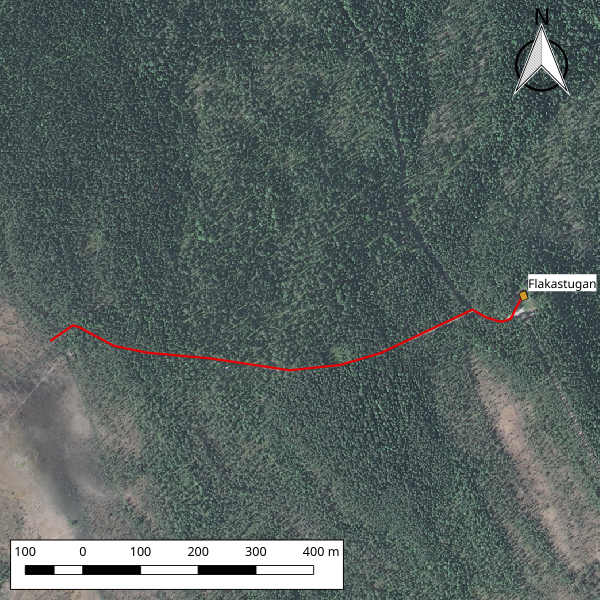
Map of the path from Flakastugan. Map Data © Lantmäteriet
If you need to work at Vargstugbäcken, drive following the instructions for Flakastugan. About 200 meters after the final left turn toward Flakastugan there is a small forest road to the right which leads up on the mountain. During summer, you can drive up this road and park in a clearing on the mountain, but during winter and spring you will have to park the car and walk up the mountain. Follow this road until you reach the mire. On the mire, you can se wooden walkways in the distance to the left, walk toward the small forested area at the edge of the walkway. Vargstugbäcken passes here, and site 17 of the Krycklan-project is marked. If you follow the water downstream you will reach to site 18, which is easy to find since it is equiped with a red dam-house.
Mats Nilsson, Professor
Soil Biology Unit, SLU
mats.b.nilsson@slu.se, +4690-786 8375, +4670-688 4409